|
Dataset ID: |
6 |
|
Name: |
Index Grid |
|
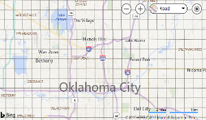
Description: |
Dataset showing a base reference grid for the Oklahoma City area. This dataset is sometimes referred to as the Fire Grid. The grid generally divides Oklahoma City into mile sections. |
|
Keywords: |
index grid fire boundaries boundary |
|
Data Updated: |
1/1/2026 6:00:01 AM |


|
Filter By Map |


|
Filter By Attribute |

|
Download |

|
|
Filter Table by Map
When this filter is applied, the displayed table contents are updated when you pan or zoom map.
For some datasets you may need to zoom the map in to see any records.
Filter Table Data
|
Field: |
|
|
Operator: |
|
|
Value: |
Download Table Data
Select Download Format:
Select Records of Interest:
* Not available on all datasets.
Preparing your file...